


Raw Facts
I still need to comb through my journal for exact specifics, but roughly here are the statistics from my hike.
- Flew out to the trail: April 25, 2011
- Flew back from the trail: October 9, 2011
- Days away from home: 169
- "Zero" days: 10
- Hiking days and zero days: 109
- Days off to move house from DC to DE: 29
- Days off waiting for spring snow storms to stop: 19
- Days off waiting for Lake Tahoe snow to stop: 2
- Miles hiked: 2,550
- Miles skipped: 100
- Most miles in a day: 48
- Target miles a day: 32-36
- Average (days hiking + zero days) miles per day: 23.4
- Photos taken: 3,500 (about)
- Weight lost: 20 lbs (170 to 150)
- Nights camped in the rain: 4 or 5
- Nights in town in the rain: 5 or 6
- Days hiking in the rain: 3 or 4
- Highest point: Mount Whitney, 14,497 feet
- Highest mountain pass: 13,153 feet
Reflections
- The PCT is more populated than I expected. It generally felt just as crowded as the Appalachian Trail - which means seeing anywhere from 1 to 50 people a day and rarely going a day without seeing someone.
- The scenery was certainly gorgeous most of the time. Sunrises and sunset didn't seem as colorful as the ones on the Appalachian Trail - not sure what that implies. Every region of the trail (southern desert, high Sierra, volcano country, north Cascades) was memorable and worth the time. It's hard to think of skipping any one section, but I do admit that the most memorable was where the John Muir Trail and Pacific Crest Trail travel side-by-side in the high Sierra. I guess I like being above 10,000 feet for long stretches of trail, surrounded by clear blue alpine lakes.
- I was hungry most of the time, and partly I am to blame for that. I generally didn't eat enough calories per day in order to carry less food and because I could fill up in town once or twice a week. I was hungry a lot on the Appalachian Trail, but on the Pacific Crest I'm guessing I was hungry 90% of the time. My stomach rarely ever gurgled or felt empty (it was trained pretty well), and I rarely ever felt depleted of energy, but rather would daydream endlessly about foods. I would dream of hitting up a Taco Bell, or pizza joint, or all-you-can-eat sushi, or just downing gallons of ice cream.
- I looked forward to towns a lot more on the Pacific Crest than I ever did on the Appalachian Trail. I believe this was entirely related to being hungry.
- My favorite trail town was Mammoth Lakes, CA. It had everything a hiker could want (including a movie theater) and a great (free) trolley to take you all over town. It had a good down-to-earth charm about it, friendly people, and a great mountainside location. I do wonder why there are more teenage skateboarders here than anywhere else I've ever visited.
I would love to get back to...
Here are the places I'd really like to get back to.
- Crater Lake, OR. A gorgeous and unique site. The crater, the lake, and the park were all amazing. Hiking is all over, but primarily you come to hike around the lake.
- Drakesbad Guest Ranch + Lassen Volcanic National Park. The ranch has a great hot spring fed pool, cabins and restaurant, surrounded by all kinds of hiking trails. Short walks can take you to hot springs, mud pots, and toxic lakes. The national park itself has a lot to offer, but it was closed when I was there due to snow. I really want to see the rest of the park.
- Sisters. Near Sisters, OR are three old volcanoes that make up the Sisters chain and some phenomenal hiking trails. I wouldn't mind returning to do some several day loops.
- Mount Adams and Goat Rocks, WA. The Goat Rocks Wilderness on the Pacific Crest Trail includes some amazing views of volcanoes (Mt Rainier, Mount Saint Helens) and a nice stretch of a very steep, very narrow, very loose rock, ridge. Unfortunately it was pretty populated with hikers and campers, but it would be a great stretch to camp nonetheless.
- Let's just say that anywhere of the 400 miles between Lone Pine, CA and Lake Tahoe would be worth visiting again. Rae Lakes, Muir Pass, or around Tuolumne Meadows (in Yosemite) in the southern half - day hikes around Sonora Pass, Carson Pass or Ebbetts Pass in the northern half. Desolation Wilderness around Lake Tahoe is the section I skipped and is supposed to be a really neat area.
[ view entry ] ( 14712 views ) | permalink | print article
The colors are all wonky because I haven't had time to work with the raw images to set it straight. Here are the last few photos I took of my aborted attempt to hike from Echo Lake to Donner Pass in 1-3' of snow. It was fun at least!

Hiking around Echo Lake.
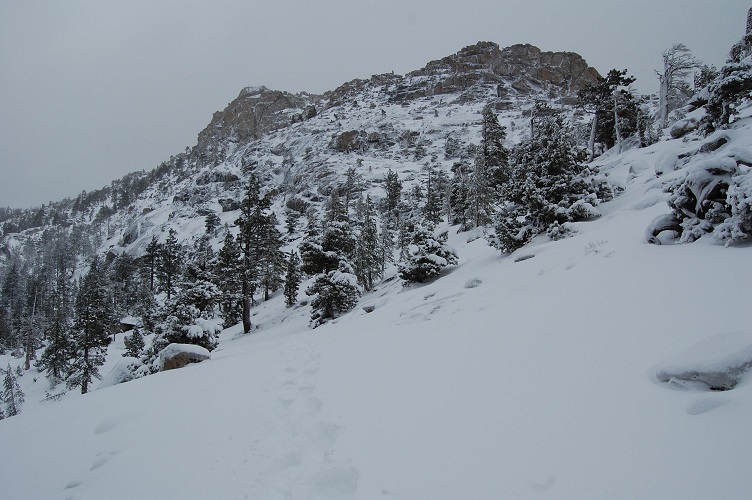
Hiking around Echo Lake.
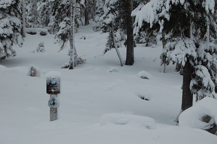
I found the trail! Sign post right above Echo Lake.
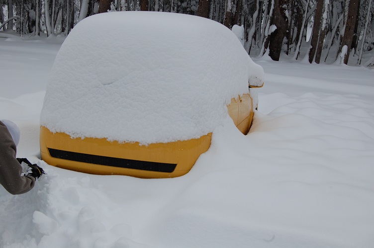
Chevy Aveo!
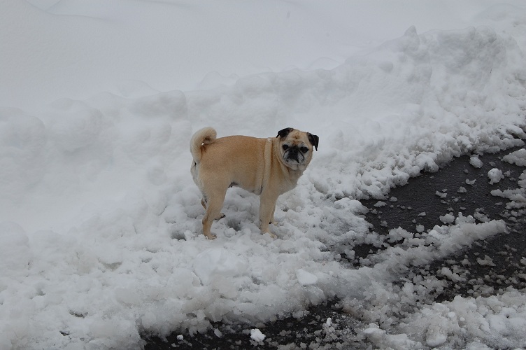
Bear!
[ view entry ] ( 76971 views ) | permalink | print article
Wow, now THAT was/is one heck of a snow storm for the first week of October! I'll get some photos up tonight of my rental car buried in snow, among other snowy shots.
So I hit the trail around 6am, beginning with a 1 mile road walk followed by a walk around Echo Lake. I say walk, but it was more of a "trudge". You see, there was indeed 1 foot of snow as a base, but on top of that was another 1 to 2 feet depending on the drifts that formed. At one point I was up to my waist - even with snowshoes. After a few hours, with cold, wet feet, the sun still hidden, and snow still coming down, I decided I was being stupid and should turn back. Especially since I would be going up 1000' in 10 miles to go up and over Dicks Pass.
And so I headed back to the road, hitched down to South Lake Tahoe, and then amazingly found a hitch not just to the exit where my car was, but to my car AND he helped shovel it out and make sure I got to the road safely. Whew!
So I'm back with Jim and Jackie in Carson City and will be meeting up with Andrea in Reno tomorrow. I am OFFICIALLY DONE WITH MY PCT HIKE! I am ultimately somewhere around 95 miles short of hiking the whole thing (40-ish between Kennedy Meadows and Lone Pine, 55-ish between Echo Lake and Truckee), but I am content. I primarily wanted to hike the PCT to get good photos and views, and I got that. And now I have another excuse to come back to Reno!
More of a recap later, I just thought you should know I'm DONE and I'm ALIVE. :)
[ view entry ] ( 10578 views ) | permalink | print article
The storm has hit. From the valley I can see lots of snow on the mountains, and the clouds are certainly thick and ominous. South Lake Tahoe itself did indeed see several inches, while other parts of the lake saw no accumulation.
Around 4pm today Jim and I were up above Truckee, CA, near Donner Pass, shuttling my dinky Chevy Aveo rental car to the trailhead so that I can hike to it. The local road to the trailhead had not been plowed, and there was about 12" of really dense snow on the ground - all fresh from this storm. My Aveo definitely could not make it down the road... heck, we spent 10 minutes digging and pushing out a Camry that somehow thought it could make it down the road. Anyhow, one of the locals had apparently gone to get a giant construction vehicle with a large plow blade to do a "mercy run" (as one of the local businessmen put it) down to the trailhead. "It won't be pretty, but you should be able to drive it." Soon the "plow" appeared, and disappeared down the road. When it came past us on the way out we quickly took advantage of the mostly cleared road before it covered over again and drove down to the trailhead.
Fortunately the trailhead has a large parking area, but the plow didn't clear any of it. So Jim and I took to digging out a parking spot to which the Aveo then went sliding into. Without sand/dirt or a lot of shoveling, the Aveo is pretty much stuck where it is, and by the time I hike to it on Friday it should be melted out enough that I can back out of my makeshift spot and cruise on down to Reno.
A hunter we ran into said there was 2' of snow at the top of the nearby mountain (one of many I would be hiking over). Fortunately I am able to borrow a pair of snowshoes from Jim and Jackie - not so much for floating on the snow (it's dense enough anyway) but to help obscure those crevices, gaps and bumps in the trail that I might otherwise find myself stepping into. I will be hiking bright and early Thurs morning, and I will definitely be carrying my long johns, rain gear, and gloves. I know my feet will be wet for most of the next 2 days, but they should at least be above freezing.
I'm optimistic that I can make good time despite the conditions. Wish me luck!
[ view entry ] ( 8010 views ) | permalink | print article
12 hours later we have a slightly larger storm predicted, hehe. From my view here in the valley floor, there are definitely large, black clouds lingering up there in the mountains. For your information, the trail from Echo Lake to Donner Pass (the 60 miles I have left) is all between 7000 and 9000 feet with one pass a little over 9000. So, yes, right in the brunt of the storm. There are a few huts that I can take refuge in, and side trails or forest roads I can use to escape down to the lake level (Tahoe) if it should come to that.
No matter, my current course is to hit the trail Thursday morning and just deal with whatever lingering mess is on the ground. Or in the air. It's certainly easier to hike on 15' of snow than it is 10 inches - since 10 inches won't quite smooth over all those gaps and crevices in the rocks/trail. Heck, it will probably feel like being back in New York!
Winter Storm Warning remains in effect from 11 PM this evening
to 2 PM PDT Wednesday above 7000 feet...
A Winter Storm Warning above 7000 feet remains in effect from
11 PM this evening to 2 PM PDT Wednesday.
* Timing: heaviest mountain snow late tonight into Wednesday
morning... with snow showers continuing into Wednesday
evening.
* Snow accumulations: 6 to 12 inches above 7000 feet... with a up
to 3 inches below 7000 feet.
* Winds: southwest winds 20 to 30 mph with gusts up to 45 mph
below ridges. Ridge gusts near 100 mph tonight and early
Wednesday morning.
* Snow levels: 7500 to 8500 feet falling below lake level by late
Wednesday morning.
* Impacts: slick and snow covered roads will make travel hazardous
over the mountain passes above 7000 feet. This includes... The
Mount rose Highway... Donner Summit... Echo Summit and Carson
Pass. Highway 4 may close during this storm.
[ view entry ] ( 6404 views ) | permalink | print article
<Back | 1 | 2 | 3 | 4 | 5 | 6 | 7 | 8 | 9 | Next> Last>>